Did You Know The Nepal Earthquake Made Mt. Everest Move About 3CM?
That's a significant movement for Mount Everest.

By Sadho Ram — 17 Jun 2015, 06:40 PM
Mt. Everest, the world's highest peak, was moved about 3 centimetres (1 inch) southwest by the 7.8 magnitude earthquake that devastated Nepal in April, Chinese authorities say
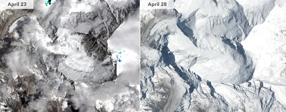
This side-by-side comparison shows Mount Everest before and after the 7.8-magnitude earthquake on 25 April.
Image via NASA Earth Observatory/LIVE ScienceThe 7.8-magnitude quake reversed the gradual northeasterly course of the world’s highest peak, which straddles Nepal and China, the National Administration of Surveying, Mapping and Geoinformation found. But its height — usually given as 8,848 meters (29,029 feet) — was unchanged by the disaster, according to the research, published in Chinese state media.
 discovery.com
The Chinese administration had set a satellite monitoring system on the peak in 2005 to observe the movement of the mountain.
In the decade since, Mt. Everest has moved 40cm to the northeast at a speed of 4cm a year, and risen 3cm over the same period.
However, that growth was all but wiped out following the quake, as satellite data, which was released by the European Space Agency, showed that the natural disaster made Everest shrink by 2.8 centimeters. The lowering is explained by a relief of strain in the Earth’s crust, the agency said citing UNAVCO, a nonprofit geoscience research consortium.
rt.comBasically, the earthquake reversed the direction of the mountain, shifting it to roughly where it would have been 9 months earlier
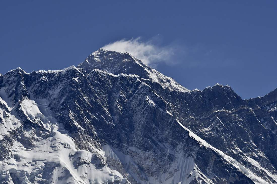
A view of Mount Everest towering over the Nupse, from the village of Tembuche in the Khumbu region of northeastern Nepal on 20 April 2015.
Image via Roberto Schmidt—AFP/Getty ImagesNepal rests on a major fault line between two tectonic plates — one bearing India pushing northward into a plate carrying Europe and Asia at a rate of about two centimeters (three-quarters of an inch) per year — the process that created the Himalayas.
Roger Bilham, professor of geological science at the University of Colorado, agreed with the Chinese findings. But he said the focus should not be on Everest, calling the peak “a lump of uneroded rock that just happens to have survived a little bit higher than all the other rocks in the Himalaya.”
“The Everest region was a mere bystander, and was pulled slightly by this movement by a few centimeters south and a little bit down,” he told AFP in an email.
discovery.com
Meanwhile, near Kathmandu, above the slipping fault, the ground was lifted by 2 meters, Richard Briggs of the U.S. Geological Survey told Live Science, but further north the ground abruptly dropped
"Movements on this fault will have affected nearby faults, and some of the faults will be promoted closer to failure [causing a quake], and some will be pulled further away from failure," Briggs said.
"The trouble we have is the timing part. We don't know where all these faults are in their kind of 'clocks' and how close they were to kind of going anyway."